Blog
Blog For Hiking, DevOps and Other Interests
West Wittering
by James
Route
Distance: 6.5 km
Elevation: ±15 m
Grade: Easy
Start: West Itchenor
Finish: East Head Beach, West Wittering
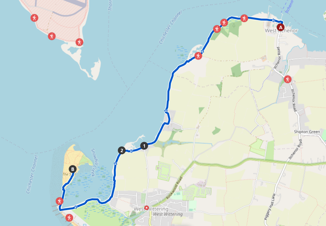
Checkpoints
- West Itchenor ( nearby)
- Protected Beach Start
- Protected Beach End
- East Head Beach ( nearby)
Dog Walking
Dog Friendliness: Friendly
I found this route to be very dog friendly; lots of opportunity for off-leading with a few areas of road and some protected beaches to be wary of (See checkpoints (1) and (2)). There is local cycling ban along this route, however, this doesn’t seem to have deterred the most committed of cyclists.
Following the sign-posts from West Itchenor going Westwards, this route is parts tarmac, gravel, and hard ground. A few parts of the route go through quiet streets with no pavements and you also have the option of walking on the pebbled beach which follows the route in parallel.
The route was quiet From West Itchenor (A) to when East Head Beach (B) came into view. East Head Beach was particularly busy; people out with their children or unleashed dog and a few protected areas on the peninsula to be careful of.
Parking
Parking in West Itchenor was relatively easy, there is a main carpark which isn’t particularly expensive but does require the download of a lesser used parking app called MiPermit. Parking can be paid for using the terminal, and whilst there is a card reader equipped it was not in operation due to poor mobile signal, an issue you will also face whilst trying to download and use MiPermit.
tags: west wittering - route - uk